
Hi, here you can download APK file "pl.trail.szlakiwgorach" for free, apk file version is 1.10 to download to your android just click this button. It's easy and warranty. We provide only original apk files
Are you going to the mountains? Enter the largest mobile mountain trail search engine in Poland! Join mountain enthusiasts, discover routes, share your routes, opinions and photos - together we create a complete and useful database of mountain trails.
"Trails in the mountains" is an application that was created thanks to the cooperation of Żywiec Zdrój, Trail.pl and the Users themselves.
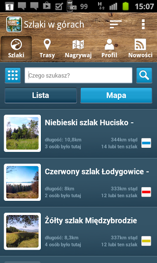
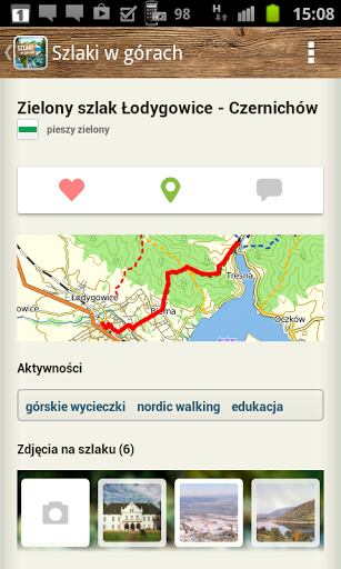
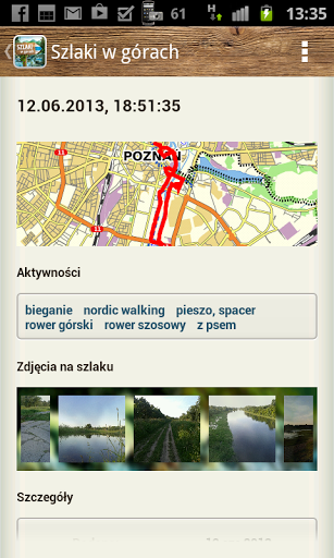
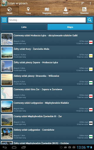
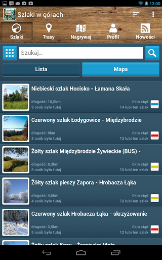
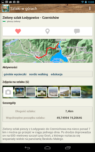
This application allows you to search and browse tourist routes and recommended by other trips. Each route is described in terms of the length and route of the trail on the map and acceptable activities, e.g. "walking", "bicycle" or "bird watching". The application also allows navigation through the selected route during the trip, using one of several available maps. With the app "Trails in the mountains" you can save your routes and share them with other mountain enthusiasts.
Application functions
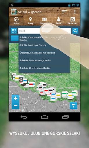
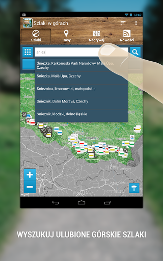
1. Searching for trails in the mountains in Poland:
● searching for routes by localities and regions in Polish mountains;
● searching for trails along the route's name;
● searching for trails on the activities available on the trail;
● Tips for locating cities;
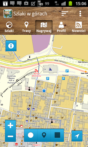
● Search by clicking with your finger on the map.
2. Viewing the routes recommended by Żywiec Zdrój and Trail.pl:
● Browse the selected route, its map, description and photos (if available);
● Zooming the map with the selected route to the entire screen of the device;
● Navigating selected routes based on GPS and data transmission from the cellular network;
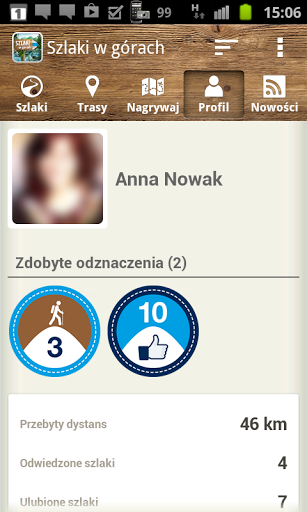
● Adding routes to favorites (only for logged in users);
● Commenting on routes along with adding photos (only for logged-in users);
● Option of reporting on the trail (only for logged in users);
● Coordinates of the trail start.
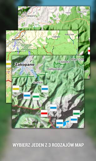
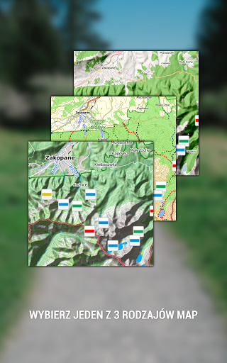
3. The ability to choose one of three types of maps:
● TRAIL routes;
● TRAIL Mobile routes;
● UMP WAW.
4. Map view options:
● "show the trail" - the map centers on the searched or suggested routes;
● "show me and trail" - the user's location is visible on the map in relation to the routes being searched or suggested;
● "show my location" - the map shows the user's location.
5. Unlimited recording, saving and describing your own routes:
● possibility of recording the route while using other functions of the phone, the so-called background recording
● view time, current and average speed, distance, distance covered and current altitude;
● saving recorded tracks as private;
● option to cancel route recording.
6. The ability to use an electronic compass (geographic setting and the magnetic north pole).
7. Using the application without logging in, with the option of saving your own offline routes in the device's memory (but without the possibility of saving them online).
8. Log in to the application via a Facebook account and save your own online routes at Trail.pl.
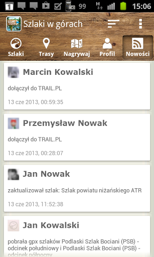
9. Adding the news tab (activity of application users and service TRAIL.PL).
Comments
When using the application, remember that its operation depends on:
● the quality of the GPS signal,
● the availability and signal strength of the cellular network,
● device efficiency
The application can complement professional GPS devices, but can not replace them.
The application uses a database of routes created by professionals and users of mountain enthusiasts. Remember that the information contained therein does not have to correspond to the current state of the routes, so always check the terrain and weather conditions immediately before setting off on a trip.
Using a GPS application running in the background can significantly reduce battery life. The quicker use of the battery on the smartphone is primarily influenced by the constantly running features of recording in the background, GPS and switched on display.


